Category:CC-BY-SA-4.0,3.0
Jump to navigation
Jump to search
Media in category "CC-BY-SA-4.0,3.0"
The following 36 files are in this category, out of 36 total.
- Benzylpiperazine legality map.svg 2,754 × 1,398; 1.05 MB
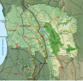
- Bergrivier LM topographic map.svg 1,198 × 1,011; 8.15 MB
- Cape Colony railways map 1910.svg 827 × 726; 224 KB
- Cape Govt Railways map 1910.svg 827 × 726; 286 KB
- Cape Main Line map.svg 1,070 × 934; 408 KB
- Cederberg LM topographic map.svg 1,113 × 1,087; 9.7 MB
- Central South African Railways map 1910.svg 778 × 771; 162 KB
- Demonland.jpg 1,887 × 1,492; 421 KB
- Guido Reni-saint sebastian-Capitoline Museum.jpg 2,448 × 3,264; 2.68 MB
- Kaart van Suid-Afrika met Afrikaanse byskrifte.svg 757 × 660; 352 KB
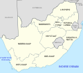
- Map of South Africa with English labels.svg 809 × 709; 540 KB
- Maseru railway line map.svg 1,529 × 392; 1.33 MB
- Matzikama LM topographic map.svg 956 × 1,268; 8.45 MB
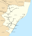
- Natal railways map 1910.svg 730 × 822; 79 KB
- NZASM line map.svg 982 × 611; 111 KB
- Ouroboros map.jpg 4,806 × 1,902; 713 KB
- Overberg railway line map.svg 1,140 × 526; 1.28 MB
- Overstrand LM topographic map.svg 1,262 × 960; 1.85 MB
- Port Alfred railway line map.svg 1,069 × 561; 1.56 MB
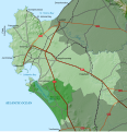
- Saldanha Bay LM topographic map.svg 1,080 × 1,120; 5.22 MB
- Shosholoza Meyl all stations 2010.svg 1,000 × 786; 961 KB
- Shosholoza Meyl main stations 2010.svg 1,000 × 786; 540 KB
- Shosholoza Meyl roete 2012.svg 1,070 × 934; 322 KB
- Shosholoza Meyl routes 2012.svg 1,070 × 934; 321 KB
- South Africa rail network map with cities.svg 1,070 × 934; 407 KB
- South Africa rail network map.svg 1,070 × 934; 230 KB
- South Africa railways map 1910.svg 1,070 × 934; 322 KB
- Sparkle logo.svg 512 × 512; 1 KB
- Swartland LM topographic map.svg 1,094 × 1,107; 7.37 MB
- Transvaal railway map 1899.svg 982 × 611; 104 KB
- West Coast railway line map.svg 467 × 1,286; 3.4 MB
- Western Cape rail network map.svg 868 × 691; 95 KB
- Western Cape topography labelled (with provincial labels).svg 1,584 × 1,262; 3.81 MB
- Western Cape topography labelled.svg 1,584 × 1,262; 3.78 MB
- Western Cape topography.svg 1,584 × 1,262; 3.18 MB


.svg/120px-Map_of_the_Western_Cape_with_municipalities_named_and_districts_shaded_(2016).svg.png)


.svg/120px-Western_Cape_topography_labelled_(with_provincial_labels).svg.png)

